

The Ramble will take place on Sunday, Oct. 12th from 3:00 to 6:00, rain or shine.
Showers are currently in the forecast [see above re: changed forecast - KB]. Bring a slicker and, as mud is a fact of life when it rains, a change of shoes or maybe some Wellies. We don't want muddy shoes in the harvest shed, please. It is a visit to a working farm, not an agritourism affair.

The harvest shed (before painting was completed).
There has been a merlin in residence, as well as a pod of meadowlarks, so binoculars may come in handy for the birders. Yellow jackets have been pretty tractable this year, but they are present and a bee sting kit is recommended if you are allergic.
There will be light fare provided by our own Linda Colwell, who has helped harvest so much of what you all enjoy at Hillsdale, and Sarah Minnick of Lovely's Fifty Fifty. No need to RSVP.

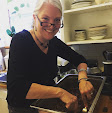
One young rambler.
Our street address is 15219 Spring Hill Road, Gaston, if you need to inform Siri. Otherwise, our directions have been working pretty well, and long before unflappable and inscrutable Siri was even a twinkle in Timothy Cook's eyes.
From Portland:
Take 26 West out of Portland toward Beaverton. Exit onto 217 (69A) toward Beaverton/Tigard. Follow 217 to the second exit (Beaverton, Routes 8 and 10, exit 2A). Take this exit and go straight across Route 8 to the second traffic light. Turn right onto Route 10, which is also called the Beaverton-Hillsdale Highway.
After crossing the railroad tracks, Beaverton-Hillsdale Highway turns into Farmington Road. After rambling on about 12 miles, Farmington Road T's onto 219.
Turn left onto 219, cross the bridge and take the first possible right turn, Bald Peak Road, in about 200 feet.
Bald Peak Road very soon splits into a “Y”. Bear to the right, staying on Bald Peak Road. You will follow Bald Peak for 3+ miles up a long hill. (Note: about half way up the hill, Laurel Road merges on the left, stay on Bald Peak Road by snaking to the right.)
The road peaks at the very top of the hill and curves sharply to the left, at the stop sign which doesn't make you stop, turn right onto Laurelwood Road, marked with a sign indicating "Scenic loop".
Go down this curvy road and through the hamlet of Laurelwood (about 3 miles) until the road T's onto Spring Hill Road. Turn left onto Spring Hill. In 1/2 mile, you will pass Gibson Road which comes in from the left. Turn right onto the next driveway. There are 2 mailboxes as we share this driveway with the Huserick Brothers nursery next-door. We have a sign.
[A quicker alternative, if less scenic, route for those coming from downtown or Northeast Portland: take Hwy. 26 west to the Glencoe Rd. exit (past Hillsboro). Take a left onto Glencoe Road, and in about a mile at the signal take a right onto NW Zion Church Road. It will turn into NW Cornelius-Schefflin Road. At the first roundabout, turn onto NW Verboort Road. At the second roundabout, turn onto NW Martin Road. It will end at Hwy. 47 (Nehalem Hwy.). Take a left into Forest Grove (mind the speed limit) and at the signal (at McMenamin's Grand Lodge) continue straight through onto Hwy. 47 to Gaston. Right after entering Gaston, take the first left onto SW Gaston Rd., then take a right at the stop sign onto SW Springhill Road. Follow a couple of curves and up and down a couple of slight hills till you pass Gibson Road which comes in from the left. Turn right onto the next driveway at the Ayers Creek Farm sign—there are two mailboxes as they share this driveway with the Huserick Brothers nursery next door.
If you're coming from Southeast, the best bet is to take Powell Blvd. across the Ross Island Bridge. Follow the signs to Hwy. 10, Barbur Blvd. Take Barbur to the Beaverton-Hillsdale Hwy. exit (still Hwy. 10) and follow it out through Beaverton. Cross the railroad tracks, then follow Anthony's directions for proceeding on Farmington Road. - KB]
From Salem and points further south:
From I-5 North, exit at Brooks (Exit 263), about 10 miles north of Salem. The stop sign turn left on to Brooklake Road. Follow the Brooklake Road for about a mile and, at the 4-way stop after crossing the railroad tracks, turn right onto River Road.
A couple of miles past the Wheatland Ferry turnoff, you must turn left towards St. Paul, this is still River Road. Stay on River Road all the way through St. Paul and then to Newburg.
River Road ends at 99W on the east side of Newburg. Turn left onto 99W and staying in the right hand lane. About a mile, you will see a sign for 240. If you are in the right lane, you will have to exit onto 240.
Take Route 240 west out of Newberg. Follow for approximately 5.5 miles. Turn right on to Ribbon Ridge Road. The sign points to Gaston. Follow the main, paved road as it swings to the left about a mile later, becoming North Valley Road. The road will meander along the side of the valley for 5.7 miles and then comes to an intersection where the main road swings to a sharp left. Go straight onto Spring Hill Road. You will see our berry fields at the top of the rise. Follow Spring Hill for approximately a mile and look for gravel driveway on the left. This is our farm's driveway.


No comments:
Post a Comment